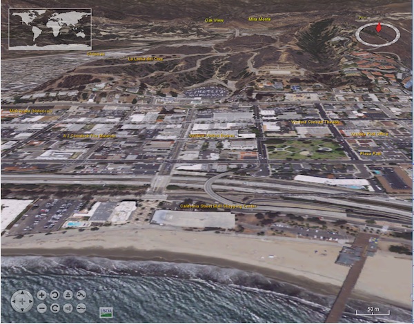
New high-resolution NAIP aerial imagery
New high-resolution USGS NAIP Plus aerial imagery is coming to NASA WorldWind. Stay tuned for more updates in the coming weeks!
The NASA WorldWind development team is working to add built-in WorldWind layers with imagery from The National Map’s USGS NAIP Plus service. WorldWind Java’s existing USGS NAIP layers that access worldwind47.arc.nasa.gov/wms will take advantage of this new imagery. Web WorldWind and WorldWind Android will get new NAIP image layers.